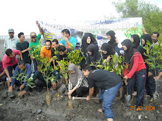
Posted by Aktivis Alam Sekitar Kampus;
| Posted in
Application
| Posted on 06 October 2008


Environmental GIS (Geography Information System) describes the use of location based data management tools to assist in the decision making processes that together form an Environmental Management strategy. The application areas of GIS are varied not only in potential users, but also in environmental sphere and specific environmental issue.
Simply put, a GIS combines layers of information about a place to give a better understanding of that location. Which layers of information are combined depends on the project theme (e.g., tracing a point source pollution event in a stream), planning a wildlife reserve buffer zone, or detecting a relationship between environmental factors and human health trends.
There have many benefits of GIS in environment. One of the main benefits of GIS is better resource management both within and outside an organization. A GIS can link data sets together by common location data, such as addresses or latitude and longitude, which helps members of the public, private environmental companies, and governmental departments share their data. By creating a shared database, information can be collected once and used many times.
The data of GIS can be used for making decision of development. Although development are important, there need a corresponding with sustainable development. Some places were not suitable for development or other name is “The sensitive land”. The sensitive land can be seen after impacts of development. GIS are important to makes a plot and analysis data about the sensitive land areas so it can avoid impacts of developments. We can’t expect the disaster happen in future. The technology helps us avoid those things.
The conclusion is GIS are the new revolution of technology. Furthermore, environment needs an analysis of data in each area so the decision maker can consider about development and management of environment.


.jpg)